Slovenia by Numbers
Geographical division of Slovenia
| Length of the border: | 1370 km (With Italy 280 km, Austria 318km, Croatia 670 km and Hungary 102 km) |
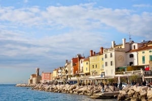
| Length of the sea coast: | 46.6 km |
| Surface: |
20,273 km2 |
| Highest Peak: | Triglav (Julian Alps) | 2,864 m |
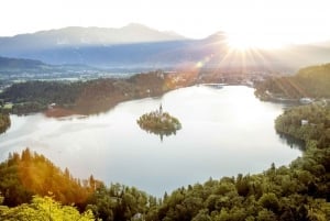
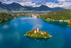
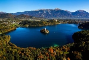
| Largest protected natural area: | Triglav National Park | 83.807 ha |
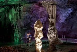
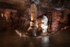
| The Longest tourist Karst cave: | Postojna cave | 203.570 km (Pivka cave, Crna cave, Otok cave, Magdelena cave) |
| The deepest tourist Karst cave: | Škocjan caves | 250m |
| Largest Lake (Intermittent) | Cerknica Lake | 26 km2 |
Surface area, Land cover (share in total area %)
| Surface area km2 | Wooden areas | All agricultural areas | Bare Soils | Water | Build-up areas | Roads | Railways |
| 20,273 | 66.0% | 27.85 | 1.6% | 0.7% | 2.8% | 1.0% | 0.1% |
Average temperature of air (ºC) in Slovenia 2008
| Station, Altitude | January | July | April-June | Average/year |
| Ljubljana- 299 m | 2.5 | 21.4 | 15.9 | 11.6 |
| Murska Sobota- 188 m | 1.8 | 20.7 | 15.9 | 11.2 |
| Novo mesto- 220 m | 2.3 | 20.8 | 15.7 | 11.3 |
| Portoro- 2 m | 6.7 | 23.5 | 17.4 | 14 |
| Ratece (Planica)- 864 m | -0.3 | 16.8 | 11.4 | 7.2 |
Population
| 2000 | 2007 | 2008 | 2009 | |
| Population | 1,990,272 | 2,019,406 | 2,032,362 | 2,056,377 |
| Average Age | 38.8 | 41.0 | 41.2 | 41.4 |
| Aging Index | 87.8 | 115.1 | 117.1 | 118.0 |
Slovenia Economic Data
| Unemployment rate (April 2011) | 11.9% |
| Gross Domestic Product- Growth Rate 1st quarter 2011 | 2.0% |
| Gross Domestic Product in millions EUR (2010) | 9,390 EUR |
| Gross Domestic Product per capita (2010) | 17,560 EUR |
| Current deficit | 5.6% GDP |
| Debt | 38.00% GDP |
| Average wage (April 2011) | 975.98 EUR |
| Current annual rate of inflation (May 2011) | 2.20% |
Find out more – connect with us on Facebook!