Slovenia in Numbers
Geographical division of Slovenia:
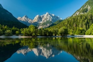
| Alps: | 42.1% of territory |
| Dinaric Alps: | 28.1% of territory |
| Pannonian Plain: | 21.2% of territory |
| Mediterranean: | 8.6% of territory |
| Length of the border: | 1370 km (With Italy 280 km, Austria 318 km, Croatia 670 km and Hungary 102 km) |
| Length of the sea coast: | 46.6 km |
| Surface: | 20,273 km2 |
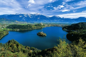
| Highest peak: | Triglav (Julian Alps) | 2,864 m |
| Largest protected natural area: | Triglav National Park | 83.807 ha |
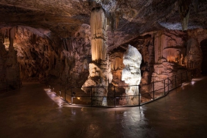
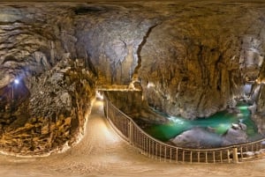
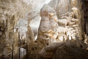
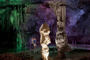
| The longest tourist Karst cave: | Postojna cave | 20.570 km (Pivka cave, Crna cave, Otok cave & Magdalena cave) |
| The deepest tourist Karst cave: | Škocjan caves | 250 m |
| Largest lake (intermittent): | Cerknica lake | 26 km2 |
Surface area, Land cover (share in total area %)
| Surface area km2 |
Wooden areas | All agricultural areas |
Bare soils | Water | Build-up areas | Roads | Railways |
|
20,273 |
66.0 % |
27.8% |
1.6% |
0.7% |
2.8% |
1.0% |
0.1% |
Average temperature of air (ºC) in Slovenia 2008
| Station; Altitude | January | July | April - June | Average/year |
| Ljubljana – 299 m | 2.5 | 21.4 | 15.9 | 11.6 |
| Murska Sobota – 188 m | 1.8 | 20.7 | 15.9 | 11.2 |
| Novo mesto – 220 m | 2.3 | 20.8 | 15.7 | 11.3 |
| Portorož – 2 m | 6.7 | 23.5 | 17.4 | 14 |
| Ratece (Planica) – 864 m | -0.3 | 16.8 | 11.4 | 7.2 |
Population
| |
2000 | 2007 | 2008 | 2009 |
| Population | 1,990,272 | 2,019,406 | 2,032,362 | 2,056,377 |
| Average age | 38.8 | 41.0 | 41.2 | 41.4 |
| Aging index | 87.8 | 115.1 | 117.1 | 118.0 |
Slovenia economic data
| Unemployment rate (September 2010): | 10.5 % |
| Gross domestic product – Growth rate II. quarter 2010 |
2.2 % |
| Gross domestic product in millions EUR (2010): | 9,390 EUR |
| Gross domestic product per capita (2010): | 17,331 EUR |
| Current deficit: | -5.8 % GDP |
| Debt: | 35.4 % GDP |
| Average wage (September 2010): | 963.84 EUR |
| Current annual rate of inflation: | 2.46 % |